The Noosa Biosphere Reserve was awarded the coveted UNESCO Michel Batisse Award 2021 for excellence in biosphere reserve management!
We entered the Keeping it Kin Kin project for the Michel Batisse Award as a case study of excellence as we believed it to be an excellent example of how all levels of government, the Noosa community and conservation groups have worked together to solve a historic environmental impact issue. NBRF Executive Coordinator, Sharon Wright presented the case study to the 33rd session of the International Coordinating Council of the UNESCO MAB Programme on 16 September 2021.
In our presentation to UNESCO, we included a video message from Phil Moran, Noosa & District Landcare, the lead organisation who delivered the project.
What the project is about
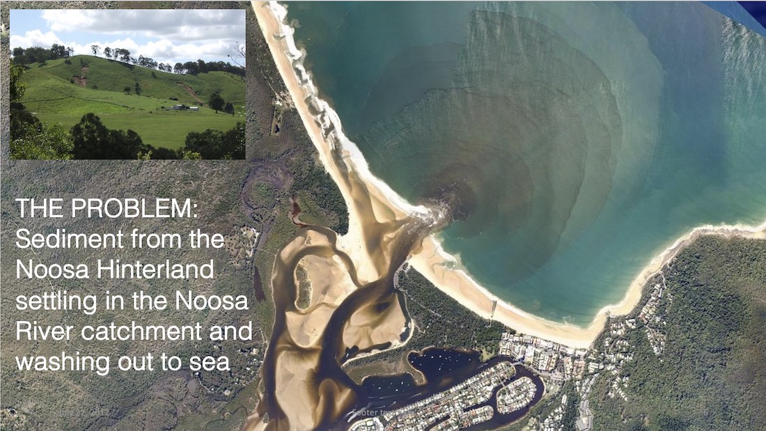
Keeping it in Kin Kin is a multi-stakeholder sediment management project led by Noosa & District Landcare, in the Noosa Hinterland town of Kin Kin, which began in 2016. The aim of the project is to reduce soil erosion and improve agricultural productivity, waterway health and water quality within the Noosa River Catchment. The project is one of three components of a broader project, that aims to progressively re-establish and restore resilient natural aquatic ecosystems in the Noosa Estuary, River and Lakes system.
HOW IT WAS APPROACHED
The project harnessed the latest science and on-ground experience to identify the areas most in need of treatment to protect and improve soil, water and vegetation systems in the Kin Kin catchment.
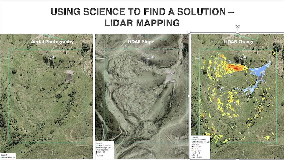
Analysis using remote sensing imagery, Light Detection and Ranging (LiDAR) and the layering of images collected over the period from 2008 – 2015, established the origin of sediment and erosion type. Comparing elevation and slope, geological and soil type and increase or loss of soil levels allowed researchers to ascertain priority areas at a sub-catchment level. Once these hot spots were identified, the region was divided into 17 sub-catchments utilising a traffic light colour coding system to highlight properties with the best chance of success through remediation work.
KEY FOCUS AREAS
The analysis identified three key focus areas: active channel & gully erosion; slumping on hillslopes; riparian/creek bank erosion.

By utilising the latest science and on-ground methods to identify priority areas, the project has successfully implemented property management plans across 12 properties (and still growing) resulting in the ongoing protection and improvement of soil, water, and vegetation systems.
The project achieved significant community buy-in from the traditionally hard-to-reach farming sector and secured considerable funding from local and federal governments due to its innovative approach to community engagement and inclusivity.
REMEDIATION MEASURES

Remediation measures included:
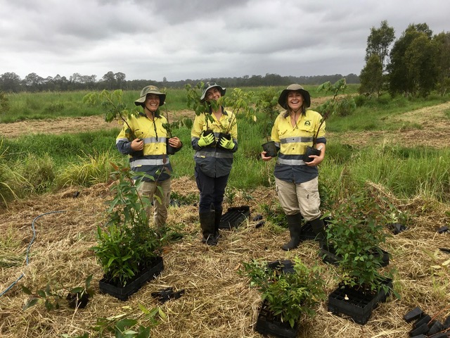
- Improving the extent and quality of the riparian zone through revegetation;
- Improving erosion prone areas such as creek crossings through revegetation;
- Installation of stock exclusion fencing along waterways, drainage lines and erosion prone areas;
- Installation of off-stream water sources;
- Recommending sustainable pasture management and agriculture practices to improve soil health;
- Checking dams and water storage for leaks and correct construction;
- installation of appropriate spillway and water flow entry points – creating water on water flow points to dissipate flow energy;
- Installation of porous dam checks or leaky weirs in gullies and runoff areas;
- Remediation of unsealed tracks and pathways;
- flow monitoring technology – trial of turbidity monitoring devices during flood events
The collaborative Keeping it in Kin Kin program has been an outstanding example of using evidence from comparative LiDAR mapping to guide and drive investment, building confidence for stakeholders and land managers to become involved in the on-ground works needed to reduce erosion.” – Julie McLellan, CEO Healthy Land and Water
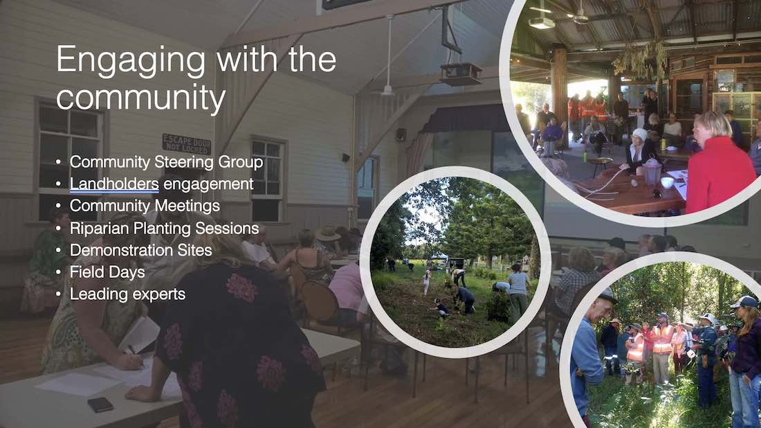
Community Engagement
A key factor in the ongoing success of this project is the community engagement strategies employed by the Noosa Landcare team to ensure long-term community conservation action and mutual benefit to landholders.
key project outcomes
Building community awareness and engagement with other local and national conservation groups, government programs and universities has ensured long-term positive results for the Noosa River catchment.
Keeping it in Kin Kin has used an innovative combination of land and water surveys, mapping and monitoring techniques in collaboration with local land-holder support and community action to develop effective solutions to this historical issue.
These actions form the basis for sustainable agriculture and related rural industries which have a flow-on effect of maintaining a sustainable tourism industry, diversifying our economy and building social capital and well-being within the Noosa Biosphere Reserve.
The project continues today
The second phase of this project, Keep on Keeping it in Kin Kin began in 2018 and was completed in 2020. Due to the success of Phases 1 and 2, Keeping it in Kin Kin has secured significant funding from Local, State and Federal governments to ensure the ongoing implementation of the project.
To learn more, visit the Keeping it in Kin Kin project page.
I would like to thank Phil Moran and the wonderful team at Noosa & District Landcare who implemented the Keeping it Kin Kin project, and project partners Noosa Shire Council, Healthy Land & Water, Noosa Parks Association, The Thomas Foundation, Kin Kin Community Group, Noosa Integrated Catchment Association and Country Noosa.” – Sharon Wright, NBRF